

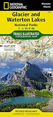
Glacier and Waterton Lakes National Parks Map - Trails Illustrated
Glacier and Waterton Lakes National Parks Map - Trails Illustrated
Price subject to change. Tap below for current.
Couldn't load pickup availability
In this review of the Glacier and Waterton Lakes National Parks Map the writer looks at who will get the most from a Trails Illustrated outdoor map and why it matters on the trail. The bottom line: this map is for hikers, backcountry travelers, and day visitors who need a durable, readable map focused on navigation and route planning. Its biggest selling point is the clear, topographic detail presented in a familiar Trails Illustrated layout that makes route finding and park orientation straightforward.
Key Features
- Topographic detail: The map shows contours and terrain features that help hikers visualize elevation changes and select appropriate routes.
- Park coverage: It covers both Glacier and Waterton Lakes National Parks on a single sheet, simplifying travel planning across the border region.
- Trails illustrated: Major and secondary trails are marked so users can compare routes and estimate distances for day hikes or multi-day trips.
- Durable format: Trails Illustrated maps are designed for field use and resist wear from handling during outdoor navigation.
- Reference information: The map includes park boundaries and key landmarks to aid orientation within the parks.
Who It's For
The map is best for hikers, backpackers, and day visitors who prefer a printed, high-detail map to supplement digital navigation tools. It is particularly useful for people who move between Glacier and Waterton Lakes parks and want consistent map styling across both areas.
Less suitable are casual tourists who only need a simple visitor guide or people who rely exclusively on smartphone apps, since the map emphasizes topographic detail over curated interpretive content.
Pros & Cons
Pros
- Clear topographic contours help with route choice and elevation awareness.
- Combined coverage of both parks reduces the need to carry multiple maps.
- Trails Illustrated format is field-oriented and built for outdoor use.
Cons
- It is a specialized map and lacks the broad interpretive visitor content some casual travelers prefer.
Specifications
| Product name | Glacier and Waterton Lakes National Parks Map (Trails Illustrated) |
| Series | Trails Illustrated Map, 215 |
| Coverage | Glacier National Park and Waterton Lakes National Park |
| Format | Outdoor/topographic trail map |
| Intended use | Hiking, route planning, backcountry navigation |
| Publisher info | Publisher listing present with map packaging details |
Our Verdict
The Glacier and Waterton Lakes Trails Illustrated map is a solid choice for anyone who needs accurate topographic detail and consolidated coverage of both parks. Hikers and backcountry travelers will appreciate the readable contours and trail layout, making it good value for anyone who wants a reliable, field-ready map rather than a general visitor brochure.
Frequently Asked Questions
Does this map cover both parks on one sheet?
Yes, it provides combined coverage of Glacier National Park and Waterton Lakes National Park for cross-park planning.
Is this map suitable for backcountry navigation?
Yes, the topographic contours and trail markings make it useful as a navigation aid when used alongside proper compass and planning.
Will it replace a GPS or app?
No, it is best used as a reliable paper backup to electronic navigation tools rather than a complete replacement.
Editor's Take
A reliable Trails Illustrated map offering combined coverage of Glacier and Waterton Lakes National Parks; ideal for hikers and backcountry travelers who need clear topographic detail and field-ready durability.

Recently viewed
Recently viewed products will appear here as customers browse the store.